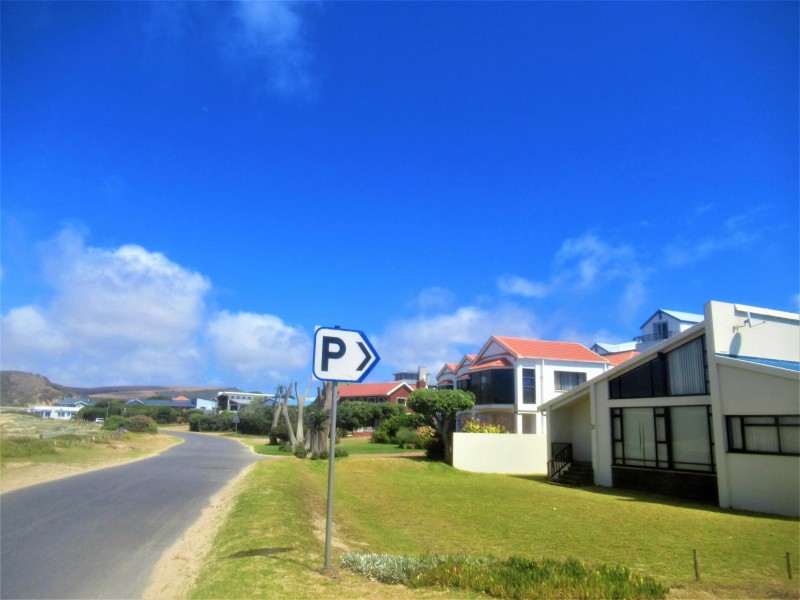
Despite several concessions being made, homeowners in Beyers Street along the pristine Little Brak River mouth and estuary are sad and deeply disappointed that the money allocated for the "unnecessary and unwanted" upgrading of the road and the provision of formal parking areas and a boardwalk is not used for more urgent matters.
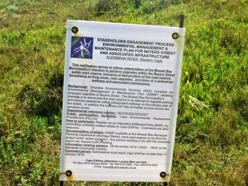
This comes after months of meetings, public participation processes and objections against the Mossel Bay Municipality's initial proposal to upgrade/reseal Beyers Street and to provide formal parking within the road reserve. The municipality's proposal, as part of its Integrated Development Plan (IDP), also includes the construction of a boardwalk within the road reserve, as well as additional formal parking within Lindt Street.
Homeowners who have lived across the river for decades are now busy identifying and removing trees, shrubbery and plants which they have planted and nurtured for decades on the "extended part of their gardens" on the road reserve - which will now be replaced by grass blocks.
The need and desirability of the costly project have been questioned and opposed from day one, as it is feared that the formal parking and boardwalk will impact on the authenticity and character of the area.
Homeowners and affected parties along Beyers Street also feel this costly project is a waste of taxpayers money and unnecessary in the light of much more urgent matters such as the cleaning up of the polluted/blocked rivers to avoid future flooding, housing shortages and ongoing legal actions regarding the homeowners of Riverside and Seemeeu Park.
The municipality's reasons for the comprehensive project - to protect the dunes south of Beyers Street from the impact of informal parking during peak holiday periods and to ensure the safety of pedestrians and motorists during high season - were also opposed and deemed unjustified.
One of the objections is that the main issues - namely parking/congestion/safety along Beyers Street - are only applicable for about two weeks of the year during peak holiday when a high volume of visitors frequent the Estuary/beach area.
"Their concern was the safety of pedestrians, but now there will be far less parking space and pedestrians will have to walk much further and cross several streets to get to the beach", one resident said.
There is also concern that the boardwalk on the dune system will be covered with sand more often than not, forcing pedestrians to walk in the road anyway despite the walkway and that the detailed impact of the project on the sensitive river mouth area has not been properly investigated/assessed in terms of the area falling within the coastal risk area and being subject to flooding.
Affected parties also feel the proposed project is against the Kleinbrak Estuarine Management Plan that specifies that there should be a reduction/cessation of inappropriate development activities in and around the Estuary. Furthermore, existing home services such as septic tanks, water meters, etc. along Beyers Street are already within the study site and the cost and impact of relocating them have not been investigated/assessed.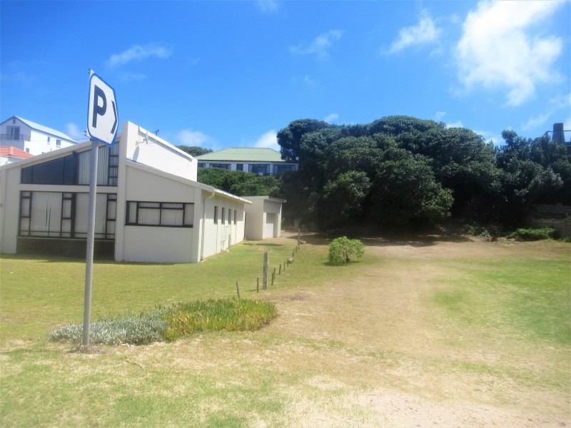
"We still feel the entire project is unnecessary and a waste of money, but are nevertheless grateful for the concessions made and have now resigned ourselves to the idea and made peace with it. We can't fight the resurfacing of the road and can only hope the proposed boardwalk, which has not yet been approved, will be cancelled", one of the homeowners said.
Registered affected parties are mainly disappointed that their counter-proposals and/or recommendation that the Status Quo be upheld, were not duly considered. Their proposals include that Beyers Street be converted into a one-way road which will enable vehicles to travel along the road whilst making sufficient space for parking within the existing road footprint;
Traffic control be implemented during the peak holiday periods to manage parking/traffic instead of creating formal parking/walkways;
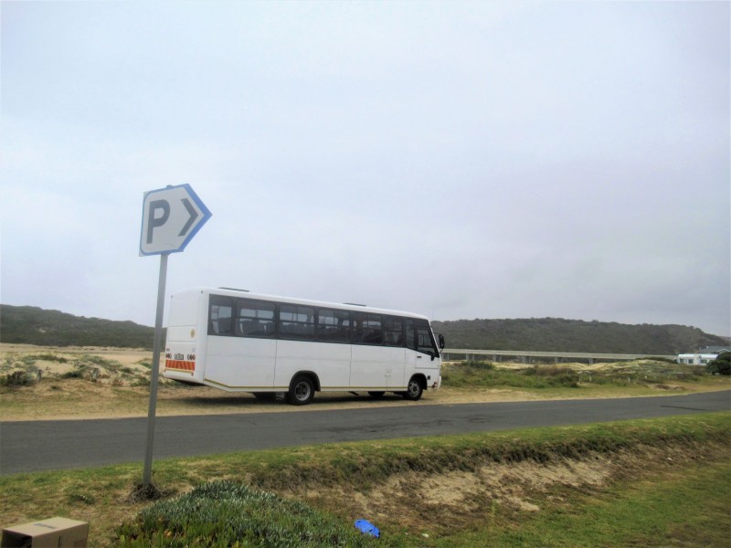
Development/utilise alternative parking areas in proximity to the beach/estuary such as the open space next to the ablution facilities or at the railway station parking;
Ice cream and food vendors can be moved to near the playground by the showers to unlock additional parking at the beach parking area.
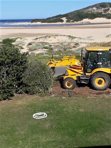
Following the heated public participation process and even threats of lawsuits, the following decisions have been made and will be implemented during April:
Grass blocks will be installed for the entire length of the section north of Beyers Street (excluding where the 15ft line comes too close to Beyers Street to make it viable).
- ·The area demarcated for the grass blocks will respect the 15ft setback from erven;
- ·These grass block areas will be seeded and the contractor will be required to water the area during the establishment phase to ensure that the area gets covered with grass;
- ·The grass block area will not be fitted with any structures that may obstruct views i.e. bollards;
- ·The grass block area will be slightly tilted towards the road to direct runoff away from individual erven;
- ·Grass blocks were selected because it is easier to accommodate and maintain existing services within this area (i.e. individual blocks can be removed should access to services be required);
- ·The Municipality still intends to fix and upgrade the road base and surface as planned originally;
- ·The Municipality intends to still erect the boardwalk along the southern side of Beyers Street to improve pedestrian safety and deter vehicles from parking on the dunes (subject to the approval of the MMP);
- ·The Municipality acknowledges the concern raised by interested and affected parties indicating that implementation of the proposed project will affect parking along Beyers Street, therefore they will commission a separate parking study to look at the available areas that stakeholders identified during the process (and possibly other areas) for establishment of more parking areas, due to the fact that approvals for such other portions of land may be different to the current process (i.e. rezoning/consent etc), such a process will be run separately;
- ·The pedestrian access (boardwalk) will be extended to link to the main parking area;
- ·Lind Street will be converted to formal parking as planned (sufficient space will be left open to allow access to erven that can only access their properties via Lind Street);
- ·The Municipality will obtain the necessary consent from the Department of Public Works for the section of boardwalk encroaching beyond the high water mark.
The Mossel Bay Municipality's motivation for this project includes the following:
Protection of the dunes south of Beyers Street from impacts associated with informal parking during the peak holiday periods when visitors visit the beach/estuary;
Safety of pedestrians and motorists during peak holiday periods when vehicles park on both sides of Beyers Street forcing pedestrians to make use of the road surface where they compete with vehicles travelling along Beyers Street;
Beyers Street requires maintenance work in the form of resealing (which will imply layer works/traffic control);
The Municipality is ultimately looking to the future, long-term development and pressure from increasing tourism to the area that requires improvements to the access/parking areas favoured by visitors; The Municipality maintains that they are responsible for and have the mandate to implement road and pedestrian safety/maintenance activities within the Beyers Street road reserve.
The following key issues/concerns were raised by participating stakeholders:
* Lack of reasonable/feasible alternatives investigated/considered during the environmental process.
* No-Go alternative has not been given due consideration in terms of the EMMP;
* Maintenance work on Beyers Street generally supported, additional (i.e. parking) and new (i.e. boardwalk) structures/infrastructure not supported for Beyers Street;
* The overall need and desirability of the project has not been proven and therefore the delegated authority cannot apply its mind in terms of the EMMP;
* Formal parking and a raised boardwalk will impact on the authenticity and character of the area and this has not been considered/investigated/assessed considering proximity to the Blue Flag Beach;
* The applicability of the Integrated Coastal Management Act (ICMA) has not been thoroughly considered and applied ito the long-term impacts of the proposal;
* The sensitive dune system along the estuarine mouth plays an important role in protecting the safety of infrastructure/structures along Beyers Street especially during coastal storm surges and flooding events – concern about the introduction of new structures/infrastructure within this area and that it has not been considered/investigated/assessed properly;
* The position of the proposed boardwalk on the dune system will result in it being covered with sand more often than not which implies that pedestrians will most likely walk in the road despite the walkway, hence the feasibility and desirability of the walkway is questioned;
* The proposal will result in a significant reduction in the number of vehicles that will be able to park along Beyers Street, thereby creating a severe shortage of parking over the peak holidays;
* The EMMP lack information about pedestrian access from the walkway to the Estuary in order to protect the dunes;
* The project cannot be justified in terms of expense/motivation since the issues being addressed, namely parking/congestion/safety along Beyers Street, applies for approximately 15-days of the year during peak holiday only when high volume of visitors frequent the Estuary/beach area, therefore the Municipality’s preferred option of implementing formal parking and a boardwalk cannot be supported;
* The proposal is in conflict with historical agreements between property owners and the Mossel Bay Municipality pertaining to specified portions within the road reserve;
* The additional ‘15ft building line’ created between the 1969 consolidated erven and the road reserve of Beyers Street was intended as a ‘buffer zone’ on which building restrictions would apply and therefore structures/infrastructure cannot be constructed within these areas;
* Concern about due process not being followed in terms of the Environmental Regulations, namely that an EMMP is not the appropriate tool to investigate and/or make an informed decision about the proposal and instead a Basic Assessment process must be followed because the new parking and walkway cannot be interpreted as ‘maintenance purposes’ irrespective whether these fall within the so-called ‘road reserve’;
* The tender procedure was followed prematurely, before the outcome of the stakeholder engagement and environmental processes;
* The mouth of the Klein Brak Estuary is a highly sensitive and dynamic area, however, the detailed impact of the project on this environment has not been properly investigated/assessed with the study area falling within the coastal risk area and subject to flooding;
* The proposed project is in contrast to the Kleinbrak Estuarine Management Plan that specifies that there should be a reduction/cessation of inappropriate development activities in and around the Estuary;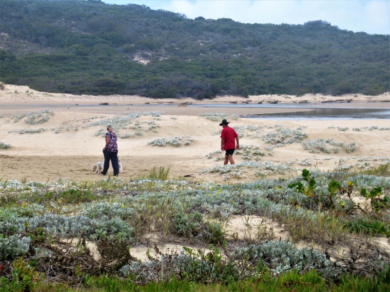
Klein Brak residents and affected parties feel formal parking and a raised boardwalk will impact on the authenticity and character of the area and this has not been considered/investigated/assessed considering proximity to the Blue Flag Beach.
- * Existing services associated with homes along Beyers Street are already situated within the study site (i.e. septic tanks, water meters) – the impact of relocating these services have not been investigated/assessed;
* The potential impact of increased flood damage as a result of the proposal has not been considered;
* Parking provided in Lind Street does not acknowledge existing accesses to homes getting access via Lind Street;
* The proposal will compromise safe access to existing properties along Beyers Street;
* Erecting a boardwalk on the Estuary side of Beyers Street will require the use of heavy machinery in some parts and the level and significance of such interventions has not been investigated/assessed;
* Concern that the Municipality will not be able to maintain the new infrastructure i.e. stormwater management, cleaning of sand, replacing of structures/infrastructure;
* The EMMP lacks detail about the project scope and does not include sufficient specialist input to make informed recommendations for maintenance and environmental management;
* The EMMP and subsequent public participation is misleading in that it refers to ‘resealing of Beyers Street’ whereas the tender information refers to complete rebuilding of Beyers Street with deep excavations/slip roads which is a ‘upgrade of the road’, not just maintenance;
* A portion of Lind Street has been closed as a ‘road’ and approved as such by the Surveyor General and therefore it cannot be claimed for public street purposes any longer;
* The proposal has not been assessed in terms of the prevailing coastal processes and insufficient information is included in the EMMP dealing with sea level rise as a result of climate change over the next 100 years i.e. disaster management requirements.
Participating stakeholders also put forward a number of alternatives they believe need to be considered by the delegated Authority (in no particular order):
Status Quo: It is submitted by most registered I&APs (read Beyers Street owners/residents/family/acquaintances) that the current scenario is acceptable to residents along Beyers Street and that should, therefore, be the preferred alternative;
Beyers Street should be converted into a one-way road which will enable vehicles to travel along the road whilst making sufficient space for parking within the existing road footprint;
Traffic control can be implemented during the peak holiday periods to manage parking/traffic instead of creating formal parking/walkways;
Development/utilise alternative parking areas in proximity to the beach/estuary such as the open space next to the ablution facilities or at the railway station parking;
Ice cream and food vendors can be moved to near the playground by the showers to unlock additional parking at the beach parking area.
It is evident that the vast majority of registered I&APs are not in favour of the Municipality’s proposal to perform upgrades to Beyers Street to accommodate formal parking and a pedestrian walkway. The proposal to formalise parking along Lind Street and to perform maintenance work on Beyers Street (resealing of the road) received much less opposition.
In the absence of broader community support for the project, there is a strong possibility that the proposal will be opposed by registered I&APs in their private capacity or in a group format irrespective of the outcome of the ongoing environmental/consultation process. The Mossel Bay Municipality is therefore at risk of implementing the current proposal with potential delays associated with legal action.
Read the follow-up to this story (with pics) here:
https://web.facebook.com/mosselbayontheline/posts/2406499676247952?
Read the complete report here:
Also, read our related articles about the situation at Mossel Bay's three rivers:
- CRY ME A RIVER . . . The UNTOLD story of Riverside in Little Brak River
- Hartenbosrivier al hoe meer besoedel en gevaarlik vir watersport
- Hartenbos-rivier GESLUIT voor feesseisoen. Wat gaan REGTIG aan by Mosselbaai se drie riviere . . . ?
- Stryd om "siek" Hartenbos-rivier te red, duur voort
- GREAT BRAK RIVER - A RIVER RUNS THROUGH IT . . . OR DOES IT?